Not long ago, drones were just intelligent birds, deemed as expensive-for-nothing military and law enforcement infrastructure, used for humanitarian support, surveillance, exerting air superiority and monitoring volatile conditions. Drone revolution is perhaps the best thing that has happened to mankind through the 20th and 21st century, and now drones have become an irreplaceable tool in geospatial data acquisition. The intelligent birds have taken over the skies, churning incredibly accurate areal datasets with amazing accuracy, and the narrative has since shifted from “drones for surveillance” to “drones for geospatial intelligence”.
Drone technology has taken the geospatial industry by storm, and it is clear that the geospatial community was not prepared for the increased versatility and applicability of drone technology in gathering various GIS datasets that can be processed to generate virgin, baseline data to support decision making at the policy level. The apt technology has proven to be the complimentary link to balance the equation of geospatial data acquisition and locational intelligence.
The current glamor of drones cannot be fully rationalized without answering the vital question, “what is it that render drones unique, capable and cutting-edge inventions in the Geospatial data industry? Well, the question has attracted confusion and curiosity in equal measures, since drones can be used in various interoperable contexts and environment, a characteristic feature of drones that most GIS fanatics and proponents were not ready for.
Why Drones? What do we know so far?
Drones are agile and robust tools that are bridging the aerial data collection gap. Initially, the only way to conduct areal mapping for vast and extensive features like tracts of forests was through a fully executed photogrammetric missions involving heavy aviation logistics like aircrafts, expensive cameras and sensors. Today, the same accuracy level of accuracy (or even more!) could be reached at half the cost using drone photogrammetry, where flight planning and execution are seamlessly conducted with little mobilization cost. Therefore, drones have become a game changer in geospatial data acquisition.
Application of Drone Solutions in the Geospatial Industry
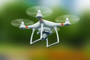
The Geospatial industry is a major consumer of the cutting-edge drone technology, overtaking the military and humanitarian support. Drones have increased field output. Today, they are such a marvel in Geospatial industry, rapidly revolutionizing field production, data capture accuracy, flexibility and versatility. With modern UAV radio and airframes architecture inspired by recent developments in avionics, new adaptable drone models with incredible capabilities have graced the market.
Currently, there are multi gimbal mount drones, that can power and support even three different payloads and still maintain an impressive service ceiling. This means an operator can fly a mission with RGB camera, thermal sensor and Lidar sensor all at once, capturing three different datasets at a stunning accuracy. The end goal of such flexibility is cutting down costs and drastically reducing project turnaround time.
Apart from increased field productivity, accuracy and efficiency, drones also automate data capture reducing, labor requirements and human error during processing. For instance, drone photogrammetric missions can be pre-planned to achieve a full autonomous operation mode with little human interference, using commercial software like Drone Deploy, pix 4D mapper, DJI Terra and e-motion for fixed wing variations. Also, modern drones are GPS-enabled, meaning that it is possible to apply both Post Processed Kinematic (PPK) and Real Time Kinematics (RTK) corrections to the data from drone base stations. These GPS corrections have automated the process of Geo-referencing and aligning models, since every image is automatically geotagged at the moment of capture.
Data collection for Geospatial applications is not the same again with the advent of the intelligent birds. Surveyors and Geomatics specialists can now do more with less in the field, and project accuracy and viability can now be looked in a different light. Drone technology is quickly evolving and so is the scope of solutions and applications. It is evident that drone technology is here to stay, which calls for non-punitive regulation and standardization of procedures to reap the best out of the technology.


Great article!
Informative👀
Stupendous!